Site plan rendering is all about taking a flat, technical blueprint and breathing life into it, turning it into a rich, photorealistic 3D model of an entire property. Think of it as creating a visual story that showcases everything—from the buildings and landscaping to the roads and lighting—long before a single shovel hits the ground. This way, everyone involved can truly see and feel the project's vision.
From Blueprint to a Living Picture
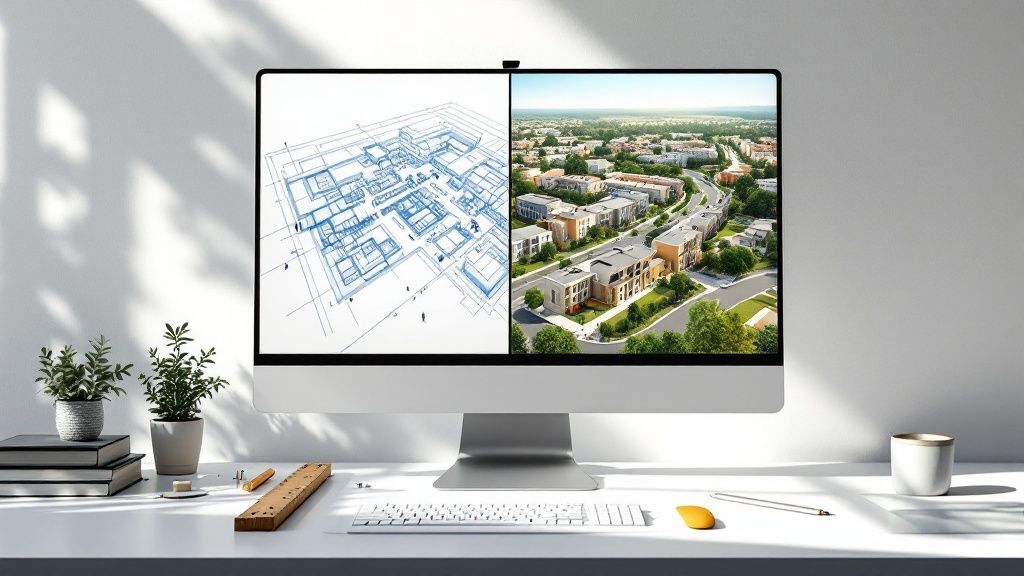
Let's forget the dry definitions for a moment. Imagine trying to get someone excited about a new housing development using just a black-and-white map. It’s accurate, sure, but it's completely lifeless. It doesn't capture the project's feel or its true scale.
Now, picture that same map transformed into an interactive, bird's-eye view, almost like you're exploring it on Google Earth. That's what site plan rendering really is.
This process is the bridge between technical drawings and what our minds can actually picture. While a 2D site plan is a functional map showing property lines and building footprints, a 3D site plan rendering adds depth, texture, and real-world context. It's the difference between reading sheet music and actually hearing the orchestra play.
What Makes a Site Plan Rendering So Powerful?
The real goal here isn't just to make things look pretty; it's to communicate a ton of complex information almost instantly. A good rendering gives you a holistic view that technical documents often hide. Stakeholders can immediately get a handle on the key relationships on the property:
-
Scale and Proportion: How big are the buildings compared to the green spaces around them?
-
Flow and Accessibility: Where are the main entrances, driveways, and footpaths? How do people move through the space?
-
Environmental Context: How will sunlight and shadows fall across the property at different times of the day?
-
Overall Atmosphere: What will it actually feel like to be there? Does it feel welcoming, modern, or serene?
By translating architectural data into a compelling visual narrative, site plan renderings ensure that investors, clients, and planning boards are all seeing the same future. It clears up any confusion and builds real confidence.
The technology that makes this possible is moving incredibly fast, becoming more accessible and more essential every year. The 3D rendering market in India is a perfect example of this boom. It pulled in around USD 167.8 million in 2024 and is on track to hit USD 519.0 million by 2030. This growth is fuelled by massive investments in urban infrastructure and real estate, where clear, detailed renderings aren't just a nice-to-have anymore—they're crucial for getting a project off the ground. You can explore more data on the 3D rendering market to see the full picture.
Why Renderings Are a Project Superpower
Let's be honest, a site plan rendering is a lot more than just a pretty picture. It's a secret weapon, a strategic tool that solves some of the biggest headaches that pop up in any construction or development project. Think of these visuals as a universal language, something that closes the communication gap between architects, clients, and city planners.
We've all been there. An architect looks at a 2D blueprint and sees a masterpiece. The client? They often just see a jumble of confusing lines and symbols. That disconnect is exactly where expensive revisions and frustrating delays are born. A realistic rendering wipes that confusion right off the table.
Building Consensus and Driving Decisions
When everyone can see a clear, tangible vision of what you're building, getting on the same page is so much easier. A top-notch site plan rendering lets stakeholders take a virtual stroll through the property, get a real feel for the layout, and understand its scale and vibe. This shared understanding is the bedrock of confident decision-making.
Suddenly, those abstract chats about setbacks, green spaces, and traffic flow become real and concrete. A city planner can instantly see how the project fits into the community, while an investor can see the potential return staring them in the face. That kind of clarity is priceless for getting everyone to agree, and quickly.
A rendering transforms a project from an idea on paper into a future reality everyone can get behind. It swaps technical jargon for a clear, visual story, making it much easier to get that all-important "yes" from everyone involved.
Accelerating Approvals and Sales
For developers, a great rendering is basically a sales engine. You can start marketing and even pre-selling properties long before a single brick is laid. Potential buyers aren't just looking at an empty plot of land; they're seeing their future home or business, complete with beautiful landscaping and glowing evening lights. That emotional tug is a massive motivator.
Renderings are also a huge help in speeding up the approvals process. When you're in front of a planning board or zoning committee, a clear visual is a thousand times more persuasive than a thick stack of technical drawings. Officials can immediately see if the project is compliant and how it will sit within the neighbourhood, cutting down on the endless back-and-forth that stalls so many projects.
This kind of clear communication is becoming critical, especially as India's architectural services market continues to expand. To put it in perspective, a big chunk of the INR 2,05,018 crore (approx. USD 25 billion) earmarked for smart city projects depends on digital tools like site plan renderings to get everyone aligned and keep construction on schedule. You can discover more insights about India's architectural market and see just how vital these visual tools have become.
At the end of the day, a site plan rendering saves time, prevents expensive misunderstandings, and builds the momentum you need to get a project from concept to completion. It’s not just another line item on the budget; it's an investment in clarity, confidence, and getting the job done right.
Bringing a Digital World to Life
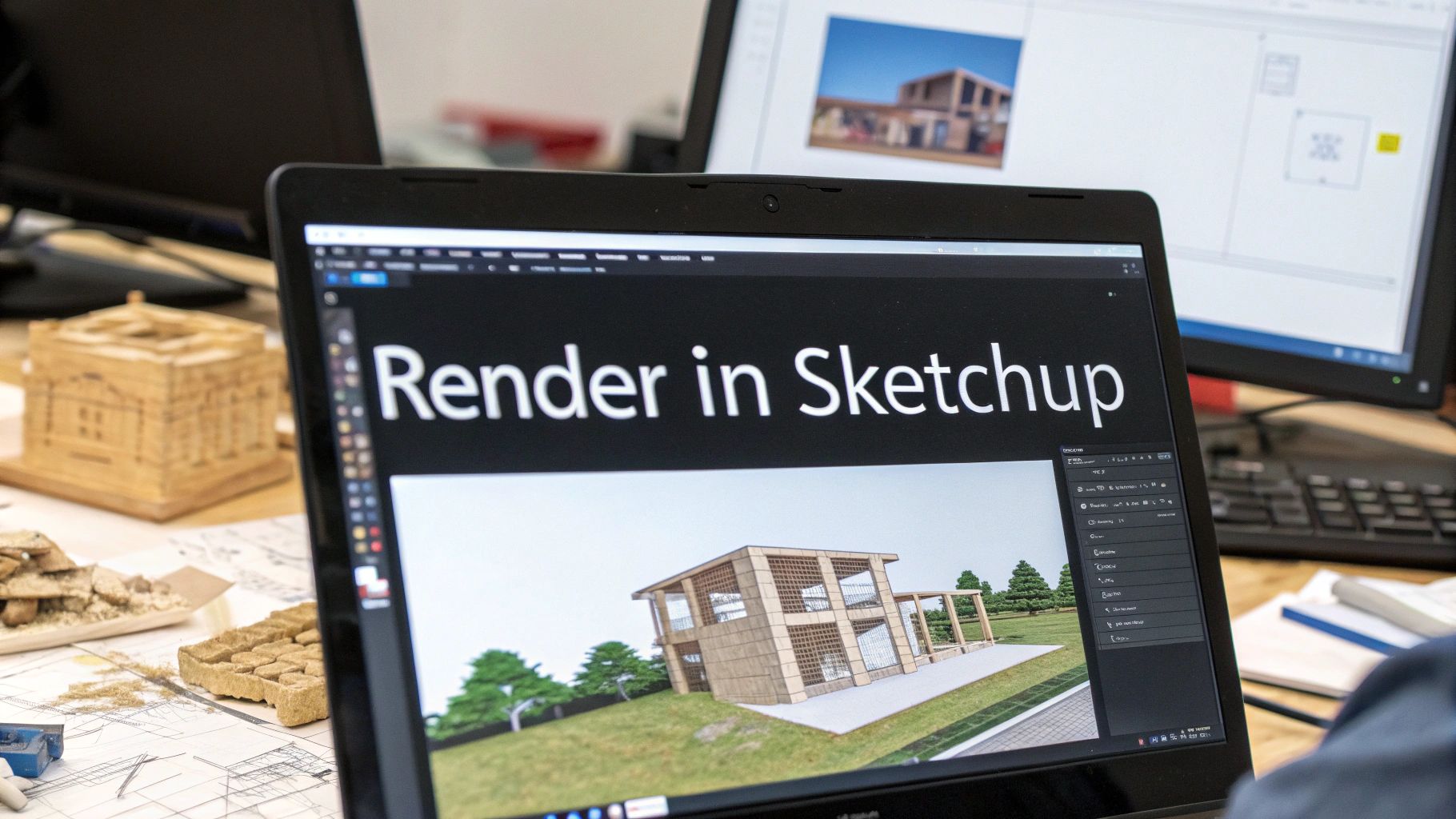
Ever looked at a stunning 3D image of a future building and wondered how it went from a flat, technical drawing to something you could almost step into? That journey is the magic of site plan rendering, and it’s a fascinating mix of technical skill and creative flair. It’s all about taking raw data and shaping it into a believable vision of what’s to come.
The whole thing kicks off by gathering the essential ingredients. Think of it like a chef getting everything prepped before they start cooking. A 3D artist needs all the right files: the architect’s detailed CAD drawings, land surveys that show every hill and slope, and a list of all the specified materials and finishes.
Constructing the Digital Foundation
Once all the raw materials are on the table, the real digital construction begins. Using some pretty powerful software, artists build a complete 3D model of the site. They take all those 2D lines and measurements from the blueprints and translate them into three-dimensional shapes. This creates a digital skeleton of the entire project, covering every building, road, and patch of grass.
At this point, it’s all about accuracy. The model has to be a perfect match for the architectural plans because it’s the foundation for all the creative work that follows. It's like building the entire development in a virtual world before anyone even thinks about pouring concrete in the real one.
This infographic gives you a bird's-eye view of how a simple site plan lays out the basic elements—property lines, building footprints, and green areas.
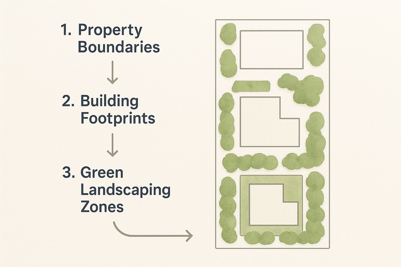
What you see here is the fundamental structure that rendering artists start with, and their job is to turn these simple shapes into a rich, detailed environment.
Adding Layers of Realism
Now for the fun part. This is where the true artistry shines. That basic 3D model is essentially a blank canvas, and the next step is to paint it with all the details that make it feel real. This happens in a few key stages:
-
Texturing: Artists wrap digital textures around every surface. They add the rough feel of brick, the cool reflection of glass, the specific grain of wood, and the gritty texture of asphalt. It’s what makes the scene feel tangible.
-
Lighting: This is crucial. Both natural and artificial lighting are meticulously set up. Artists will simulate the sun's path to cast realistic shadows and highlights, and then add things like streetlights or glowing interior lights to create the perfect mood.
-
Entourage: The scene is then populated with elements that breathe life into it. This means adding realistic-looking trees and plants, placing cars on the roads, and even adding people to make the world feel dynamic and lived-in.
The final, critical phase is the rendering itself. This is when the computer takes all that information—the model, textures, lighting, and entourage—and processes it to generate the final, high-resolution image. It's a seriously intensive calculation that can take hours.
Once the first render pops out, artists often jump into post-production. Using tools a lot like photo-editing software, they’ll fine-tune the colour balance, tweak the contrast, and add atmospheric effects like a bit of morning fog or a subtle lens flare. These are the finishing touches that take an image from a simple visualisation to a genuinely captivating piece of art that perfectly captures the project's vision.
How Different Industries Use Site Plan Renders
A site plan render isn't just some generic tool you can apply anywhere; it's more like a Swiss Army knife, with a specific blade for every job. Whether you're mapping out a sprawling housing community or a busy city centre, these visuals are what bring huge projects to life. They become the common language everyone can understand, turning abstract blueprints into something people can actually see and get excited about.
Take residential real estate, for example. A developer isn't just selling floor plans for a new set of luxury villas or a high-rise apartment block. They're selling a dream, a lifestyle. A good site plan rendering does exactly that. It shows potential buyers what it will feel like to live there—where the kids' park is, how the swimming pool connects to the clubhouse, and the kind of view they'll get from their balcony.
Driving Commercial and Public Sector Projects
When you jump into the commercial world, the stakes get even higher. If you're planning a massive IT park or a new shopping centre, your visuals need to do more than just look pretty. They’re a crucial part of your pitch to attract big-name tenants and lock down investors. The rendering gives businesses a clear preview of their future headquarters, showing them everything from access roads and parking to the overall vibe of the place. This is especially true in India’s fast-growing commercial construction market, where getting everyone on board relies heavily on these visuals.
The commercial construction scene is set to rocket to USD 240.58 billion by 2030, mostly thanks to new industrial and IT projects. With the government earmarking USD 135.1 billion for public commercial works, crystal-clear renderings are often a non-negotiable part of the approval process. You can learn more about India's commercial construction growth and see just how important digital tools have become.
Urban planning is another field where you simply can't do without site plan renders. Imagine a city government wants to build a new public park, a metro station, or upgrade a major road. Getting the public on side is everything.
Renderings transform complex civic plans into easy-to-understand visuals, allowing citizens to see the benefits and engage with the project constructively. It bridges the gap between official blueprints and community understanding.
Instead of rolling out dry, technical drawings at a town hall meeting, planners can show off vibrant, realistic images of what's coming. It’s a small change that makes a huge difference, helping to build public support and making the approvals process a whole lot smoother.
At the end of the day, it doesn't matter if it's a home, an office, or a park. The goal of a site plan rendering is always the same: to make the vision perfectly clear, build confidence in the project, and turn a shared idea into a reality you can walk through.
Choosing Your Rendering Partner and Tools
So, you're ready to bring your project to life with a stunning visual? The first big decision is figuring out how to get it done. You've really got two main paths: you can team up with a specialised rendering studio, or you can roll up your sleeves and get hands-on with the software yourself.
Both routes can get you to an incredible final product, but they demand very different things from you in terms of time, money, and effort. Let's break it down.
Finding the Right Rendering Studio
Hiring a rendering partner isn't so different from bringing on any other key collaborator. It's about finding a team that not only has the technical skill but also genuinely gets your creative vision. It’s easy to be wowed by a flashy portfolio, but you need to look a little deeper.
A great partnership is built on asking the right questions from the get-go. Before you sign anything, get clear answers on a few key points to save yourself a world of headaches later.
-
Communication Style: How do they handle feedback? What does their revision process look like? You need a partner who is responsive and collaborative, not one who goes silent for days on end.
-
Turnaround Times: Be direct. Ask them for typical delivery times for a site plan rendering at your project's scale and complexity. Get this in writing to keep everyone on the same page.
-
Pricing Structure: Is it a flat fee? An hourly rate? Make sure you understand exactly what’s included and what might trigger extra costs down the line.
A good fit isn't just about the final image; it’s about the entire experience. A studio that communicates clearly and delivers on time is worth its weight in gold.
Understanding the Technology
If you’re the hands-on type or simply want to keep full control over the creative process, then diving into rendering software is your best bet. The tools out there today are seriously powerful, but each has its own personality and strengths.
For anyone just getting their feet wet, or for pros on a tight deadline, AI-powered platforms are changing the game. Tools from Vibe3D are a perfect example—they're built to transform your 3D models into photorealistic renders in seconds, making them fantastic for quick turnarounds and exploring different ideas.
Of course, there are also the established industry workhorses. It helps to know what they are and what they do best.
Popular Rendering Software At a Glance
Here’s a simplified look at some of the most common rendering tools to give you an idea of the landscape.
| Software | Best For | Learning Curve |
|---|---|---|
| Lumion | Fast, high-quality visualisations for architectural presentations. | Beginner-Friendly |
| V-Ray | Photorealistic results with deep control; a plugin for other 3D software. | Intermediate to Advanced |
| Unreal Engine | Real-time, interactive walkthroughs and immersive experiences. | Steep / Expert |
This is just a starting point, of course. Each tool has a dedicated community and tons of tutorials to help you along.
Ultimately, choosing the right tool or partner comes down to your budget, your timeline, and how much creative control you want over the final site plan rendering. Whether you decide to hire an expert or become one yourself, knowing your options is the first step to making a smart decision.
The Future of Architectural Visualisation
Static images of a site plan rendering are powerful, no doubt. But they're fast becoming just one piece of a much bigger, more interactive puzzle. The world of architectural visualisation is moving at a dizzying speed, shifting away from simple pictures and into dynamic, immersive experiences that are completely changing how we design, get approvals, and sell property.
This evolution is pushing the limits of what we thought was possible. It's turning passive viewing into active participation for everyone involved in a project.
Real-Time Rendering and Immersive Realities
One of the most exciting shifts we're seeing is the rise of real-time rendering. Picture this: a client takes a virtual stroll through a digital model of their future home and suggests changes as they go. With real-time tech, you could switch out materials, play with the lighting, or even reposition walls and see the changes happen instantly. This turns a slow back-and-forth review into a fluid, collaborative design session.
Taking this idea even further, Virtual and Augmented Reality (VR/AR) are creating experiences you can truly step into.
-
Virtual Reality (VR): This is where clients and stakeholders can pop on a headset and literally stand inside a building that doesn't even exist yet. They can walk from room to room or step out onto a virtual balcony to check out the view firsthand.
-
Augmented Reality (AR): This technology lays digital information over the real world. A developer could be standing on an empty plot of land, hold up a tablet, and see a full-scale 3D model of the proposed building standing right there in front of them.
These technologies are dissolving the final barriers between imagination and reality. They give you a sense of scale, depth, and presence that a traditional 2D drawing or even a static 3D image just can't touch.
The Role of Artificial Intelligence
And then there's Artificial Intelligence (AI), which is poised to put the entire workflow into overdrive. AI is already starting to handle the tedious, time-sucking tasks, like filling a scene with realistic landscaping or figuring out the best camera angles for the most powerful shots.
Platforms like Vibe3D are leading the charge here, using AI to generate photorealistic visuals in seconds, which massively speeds up the whole iteration process. As AI gets more woven into our work, it will make site plan rendering not only faster but smarter, helping designers create better, more captivating visualisations with a lot less grunt work.
Got Questions About Site Plan Rendering? Let's Clear a Few Things Up.
If you’re diving into the world of architectural visualisation, you’ve probably got a few questions buzzing around. It's totally normal. Let's tackle some of the most common ones so you can get a clearer picture.
Site Plan vs. Floor Plan: What's the Difference?
This one comes up all the time. Think of it like this: a floor plan is your zoomed-in, inside-the-house view. It shows you the layout of rooms, where the walls go, and how you’d walk from the kitchen to the living room on one specific level.
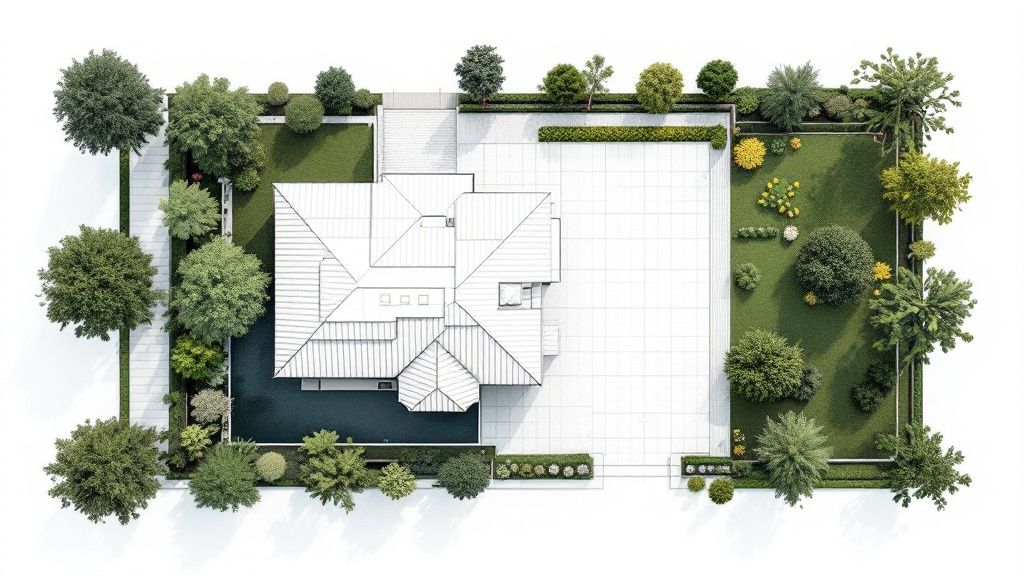
A site plan rendering, on the other hand, is the bird's-eye view. It’s the whole shebang. You're looking down on the entire property, seeing how buildings sit in relation to each other, where the gardens are, the sweep of the driveway, and even where the property lines are drawn. It shows context, not just the interior.
Okay, So How Much Does This Actually Cost?
Ah, the million-pound question. The honest answer is... it depends. The price tag for a site plan rendering can swing pretty wildly based on a few key things: how complex the project is, the sheer amount of detail you need, and the experience of the team you hire.
A simple visualisation for a single home might just be a few hundred pounds. But if you’re talking about a massive, intricate development with tons of features, you could be looking at several thousand. The best move is always to chat with a few studios and get quotes tailored to your project.
It helps to reframe this not as a cost, but as an investment. Getting everyone on the same page with a crystal-clear visual can save a fortune down the line by avoiding expensive mistakes and speeding up everything from planning approvals to sales.
And How Long Will It Take?
Just like cost, the timeline is all about complexity. A fairly straightforward rendering can often be turned around in just a few days.
But a highly detailed, sprawling site plan for a major development? That’s going to take more time, sometimes several weeks, to get every last detail just right. The absolute key here is having a clear and open line of communication with your rendering partner to make sure your timelines match up.
Ready to create stunning architectural visuals in seconds, not weeks? With Vibe3D, you can transform your models into photorealistic renders effortlessly. Explore how Vibe3D can accelerate your workflow today.